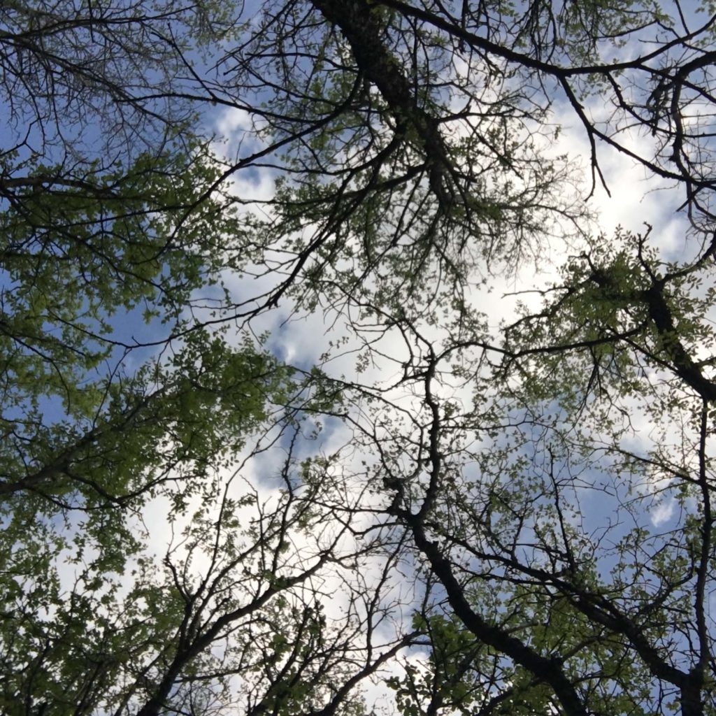
Have you heard of Shinrin-yoku? The Japanese concept of Shinrin-yoku or forest bathing advocates leisurely walks on gentle paths under a living forest canopy for healing and preventive health benefits. Here are a few hiking trails in Plano and Dallas are perfect for some forest bathing.
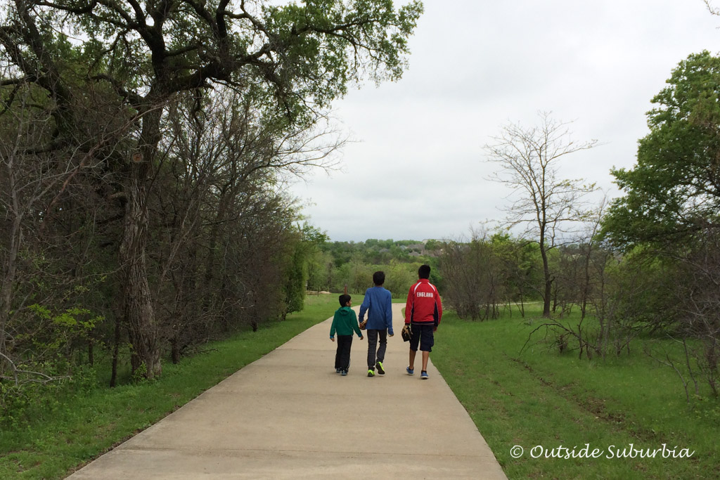
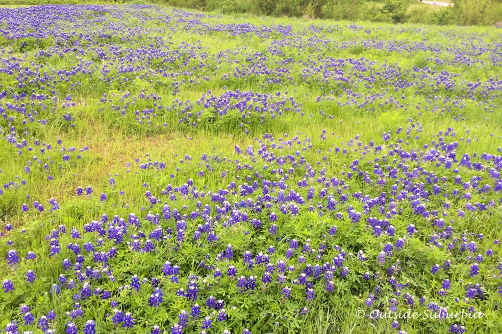
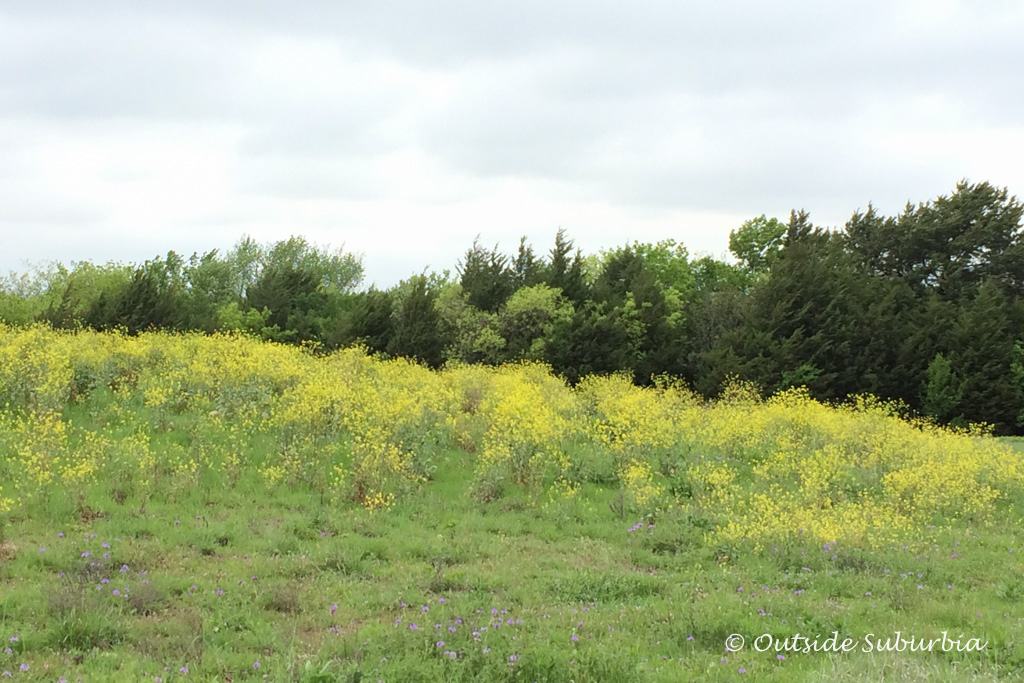
Spring is in the air- we Dallasites know it only lasts a couple of weeks before it gets hot and humid, it is time to hit the abundant hiking trails both inside and outside suburbia. This time of the year some of the trails especially the bluebonnet trail has carpets of bluebonnets and wildflowers in full bloom rivaling the likes of lavender fields of Provence. I usually stick to my neighborhood hiking trails in Plano but I decide to get out there and explore a few trails outside my usual stomping grounds as part of my get Outside Suburbia program 😉 Want to join me? Let’s get off that couch and go pound the pavements…
WHAT IS IN THIS POST
Best hiking trails in Plano & Dallas
Best Hiking Trails in Plano
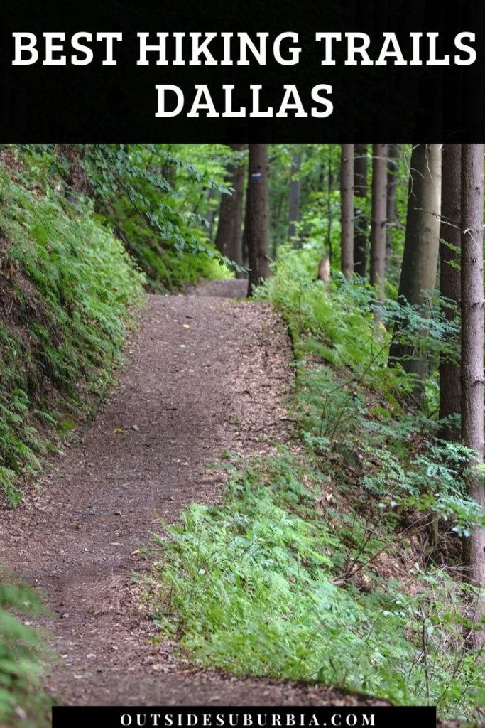
Arbor Hills Trail 3 miles
The Arbor Hills Trail is a part of the City of Plano trail system and is one of our favorites and IMHO best hiking trails in Plano! Arbor Hills Nature Preserve is a 200-acre park with hike and bike trails, a 2-mile walking trail and stunning views of the prairie and forest. There are multiple hiking trails you can go on inside the nature preserve under a canopy of trees There is a trail that loops through the Arbor Hills area of Plano, for a total of 3 miles of trail.
Trail end points: Arbor Vista Drive and W. Parker Road
Bob Woodruff Park Trail 3.7 miles
The Bob Woodruff Park Trail is a part of the City of Plano trails system. This trail, composed of a loop and several spurs within Bob Woodruff Park, also connects to the Santa Fe Trail as well as the Oak Point Park & Nature Preserve Trail. The trail also connects to a number of community features including Armstrong Middle School, Dooley Elementary and the Outdoor Learning Center. The southern portion of Bob Woodruff Park is also where Plano’s oldest resident lives, the Quincentennial Bur Oak.
Trail end points: Bob Woodruff Park, Plano and
Oak Point Park 3 miles
The Oak Point Park & Nature Preserve Trail is a part of the City of Plano trail system. This trail winds its way through Oak Point Park & Nature Preserve and includes a short loop for a total of 3.4 miles of trail. During the summer you can see people kayaking in the lake. This one of the best hiking trails in Plano. It is wide enough and good for riding bikes as well. There are 3.5 miles of concrete trails and about 5 miles of soft-surface trails along Rowlett Creek. The trail also connects on its southern end to the Bob Woodruff Park Trail.
Trail end points: Los Rios Blvd. and Cloverhaven Way and Parker Road, just east of Spring Creek Parkway
Hoblitzelle Park Trail 3.6 miles
The Hoblitzelle Park Trail is a part of the City of Plano trails system. This trail consists of a small network of loops and spurs around Hoblitzelle Park in Plano. The trail offers a total of 3.6 miles of trail infrastructure and connects to Hendrick Middle School and Hedgcoxe Elementary School.
Trail end points: Hoblitzelle Park, Plano and Enfield Park, Plano
Chisholm Trail 9.3 miles
The Chisholm Trail is a part of the City of Plano trail system. This trail extends on the South from Harrington Park to the North end of Jack Carter Park and connects along the way to the Bluebonnet Trail. The trail also connects to the Plano Senior Center, Harrington Park, Copper Creek Playground, Big Lake Park, Christie Elementary School, Carpenter Middle School, Schimelpfenig Library, Memorial Park, the Dog Park, Jack Carter Park, Carlisle Elementary, Schimelpfenig Middle School, and Jack Carter Pool. Chisholm Trail provides a continuous trail connection from 15th Street to Legacy Dr. with major street crossings.
Trail end points: Harrington Park and Jack Carter Park
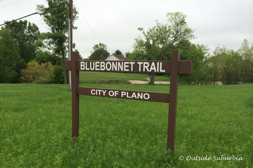
Bluebonnet Trail
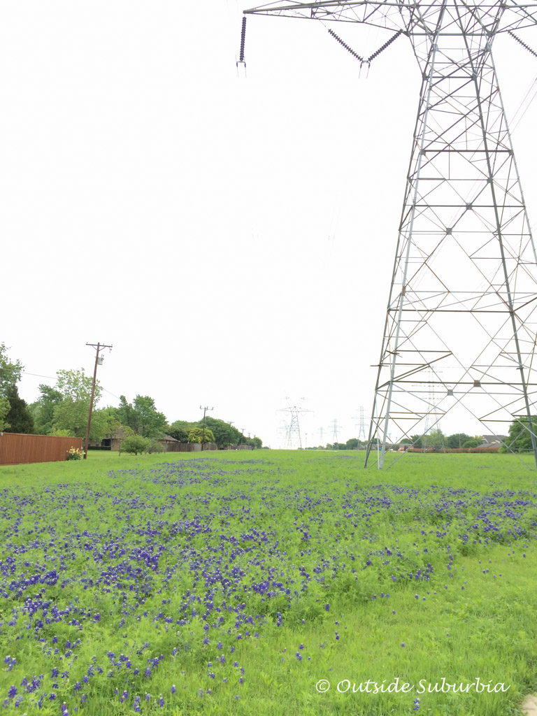
The Bluebonnet Trail extends over 10 miles, with a short break near Preston Rd. Bluebonnet Trail provides a continuous trail connection with at grade street crossings from K Avenue/ Greenway Avenue to Midway Rd. The Bluebonnet Trail connects to a number of other Plano trails including the Blue Ridge Park Trail, the Preston Ridge Trail, the Shady Brook Trail, and the Chisholm Trail. The trail also connects to High Point Athletic Fields, the Dog Park, Jack Carter Park, Lone Star Park, Carpenter Park and Recreation Center, and Archgate Park. You can see a lot of bluebonnets on the trail during spring. But the trail does run under two sets of high-voltage electric lines.
Trail end points: K Ave./ Greenway Ave. and Midway Rd.
Hiking Trails near Plano
Watters Creek Loop
Another great hiking trail near Plano is the Watters Creek Loop. It is a 2.6 mile loop trail located in Allen, Texas that features a river and is good for all skill levels. It is has a good amount of shade thanks to the trees. The trail is perfect for walking or running. This hiking trail near Plano is good for biking as well.
Trail end points: Parking lot near Nothing Bundt Cake in Watters Creek
Erwin Park North Loop
If you are looking for a great trail near McKinney, Texas, you will like the Erwin Municipal Park Trails. While the Erwin Park Trail is 9 miles, the Erwin Park North Loop is 2.7 miles and moderate trail for walking in nature.
Trail end points: Many near 4300 Co Rd 1006, McKinney, TX
Best Hiking Trails in Dallas
Katy Trail 3.5 miles
The Katy Trail in Dallas is one of the popular hiking trails in Dallas. This premier urban trail links the business district with recreational opportunities, shopping, and urban residents. The corridor is a popular route for families to ride bikes and to commute between home and work or school, as well as to recreation and entertainment venues.
In addition to its paved surface, Dallas’s Katy Trail includes an adjacent soft-surface track for runners and walkers. You will see many people running, walking their dogs and sometimes even enjoying picnics in the grassy area. The trail runs between Dallas’s West End and the American Airlines Center arena, traversing the city’s urban core past Knox Street, Southern Methodist University and the Mockingbird DART Station.
Trail end points: Lyte Street at AA Center arena and Ridgewood Trail at Mockingbird Lane bridge
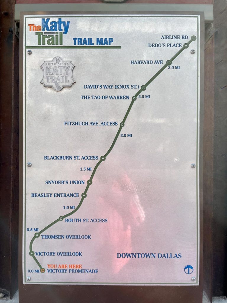
There are several artfully constructed access points along its route. There are plans to link the Katy Trail from the McCommas Boulevard area with the White Rock Lake trails. In the meantime, a dedicated lane is being constructed so that you can continue north by crossing North Central Expressway via the McCommas Boulevard overpass. Eventually, a suspension bridge over Mockingbird Lane will allow easier access to the Katy Trail and increase the distance for cyclists.
White Rock Lake Park Loop Trail 9.4 miles
The White Rock Lake Park Loop Trail is a part of the City of Dallas trails system. This loop trail is one of Dallas’ most popular trails. The trail follows the shoreline of White Rock Lake and connects many of the features and amenities within the park. This trail also connects to the Union Pacific Trail, the Santa Fe Trail, the Katy Spur Trail, and the White Rock Creek Trail (North). Stick to the west side which is better maintained. Best hiking trail in Dallas to catch a sunset!
Trail end points: W. Lawther Dr. (White Rock Lake) and W. Lawther Dr.
Lakeside Park in Highland Park
Located between Beverly Drive and Armstrong Parkway in Highland Park, Lakeside Park is home to scenic trails and pretty water features. Look for a stone mini waterfall behind the bridge on top of the Turtle Creek Dam and a similar one closer to Armstrong Parkway. There are benches throughout the park that make for excellent people watching or reading. Lakeside is also famous for its big teddy bear statues located at the end of the bridge. Walk the trail beside Turtle Creek to take in the most natural beauty. You can also bring a picnic to enjoy in the beautiful natural setting at Lakeside Park in Dallas.
Trail end points: 4601 Lakeside Drive, University Park
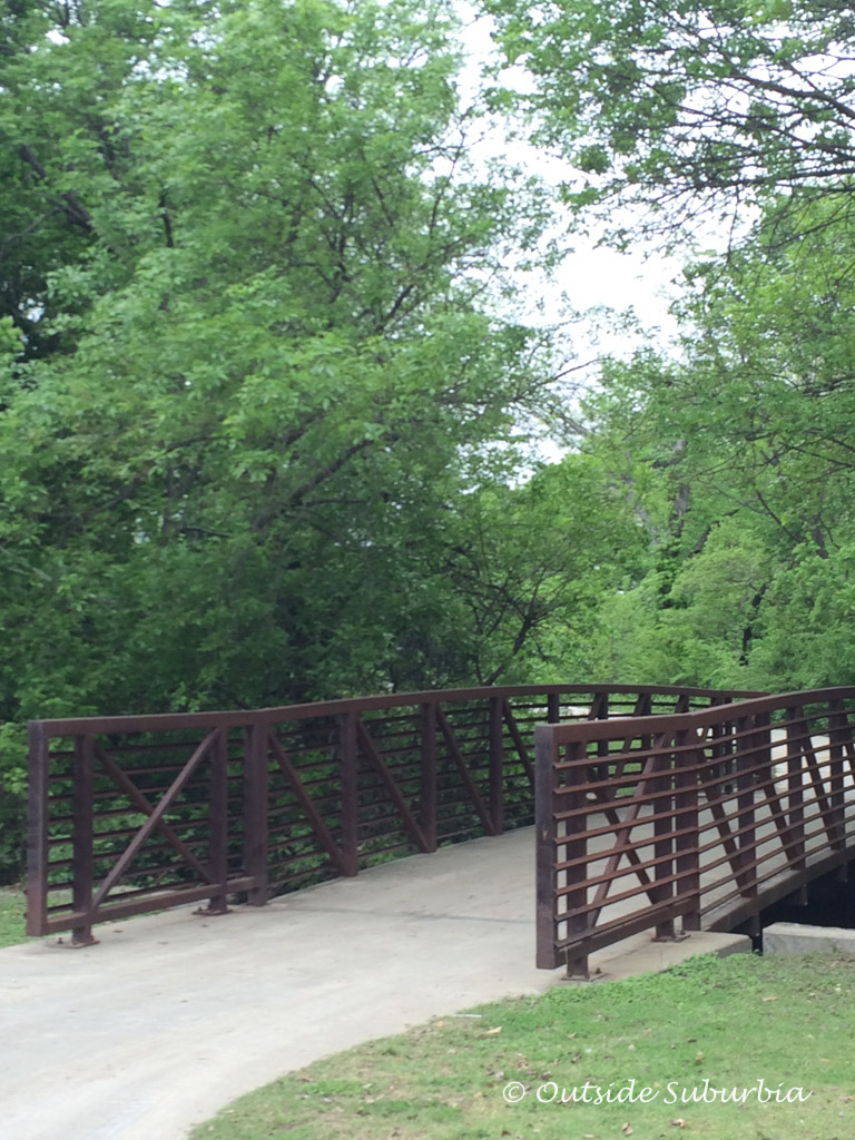
Trinity Skyline Trail 5 miles
On the Trinity Skyline Trail, you can explore the Trinity River in downtown Dallas. The paved trail currently connects to a pedestrian bridge – Continental Avenue Bridge. In the future, it will connect to the Santa Fe Trail and the Trinity Strand Trail. This is one of the nice hiking trails in Dallas that will allow those who want to enjoy nature and the outdoors the opportunity to do so without leaving the city.
Trail end points: Parking is available in Trammell Crow Park (3700 Sylvan Avenue), at the Continental Avenue Bridge (109 Continental Avenue) and at the Trinity Overlook at 110 W. Commerce Street.
Spring Creek Trail 4.4 miles
The heavily wooded Spring Creek Trail offers a natural retreat through Richardson, a northern suburb of Dallas, as it winds along the picturesque creek for which it’s named. The eastern half of the trail runs through Spring Creek Nature Area, a 51-acre park offering picnic areas, restrooms, and other amenities.
Trail end points: E. Renner Road and N. Plano Road
Santa Fe Trail 4.2 miles
The Santa Fe Trail is a part of the City of Dallas trails system. This 4.2 mile concrete surface trail connects multiple parks throughout lower east Dallas and lies on a former railroad right of way. It currently connects to both the White Rock Lake Park Loop Trail and the Union Pacific Trail.
Trail end points: S. Hill Ave., Dallas and Winstead Dr., Dallas
Trinity River Audubon Center
Ten miles south of downtown Dallas is Trinity River Audubon Center. The center’s AT&T Trail, which runs between the center and a trailhead at Elam Road, is 4.3 miles. This Dallas hiking trail in one of the best. Bring your binoculars for this Dallas hiking trail, it is a great spot for birdwatching. The Trinity River Audubon Center was built on a former illegal dump site but now draws an array of birds including colorful bunting, hawks, owls, ducks, hummingbirds and finches.
Trail end points: 6500 Great Trinity Forest Way, Dallas
Cedar Hill State Park
Cedar Hill State Park is located just ten miles southwest of Dallas on FM 1382 and the eastern shore of Joe Pool Lake in Cedar Hill, Texas. There are many hiking trails to choose from once you enter the state park and park your vehicle. Adults and kids can even enjoy Geocaching, a modern-day treasure hunt where you use a smartphone to find the cache aka hidden treasures. You can go for a swim, launch a boat and enjoy some quiet time or fish from the shore for which you don’t need a fishing license.
Trail end points: 1570 FM1382, Cedar Hill, TX 75104
Cedar Ridge Preserve
Located near the Cedar Hill State Park, Cedar Ridge Preserve offers 9 miles of hiking trails through 600 acres of hill country habitat. There are 13 walking trails are color-coded on the preserve’s online map. It is another great place for birdwatching near Dallas.
Trail end points: 7171 Mountain Creek Pkwy, Dallas, TX 75249
If you want to learn more about Shinrin-yoku, here is the article I wrote on Plano Magazine. See AllTrails for more trails near Plano and Dallas.
You might also like:
Best Ice cream shops in Plano
30 Great Plano Restaurants
Best Coffee Shops in the Dallas Fort Worth Area
Best Staycation Ideas to Travel the World without Leaving Dallas
How to Spend a Weekend in Dallas with your Girlfriends
Best Instagrammabe spots in Dallas
UPDATED March 2022
PIN IT FOR LATER

CONNECT WITH US